


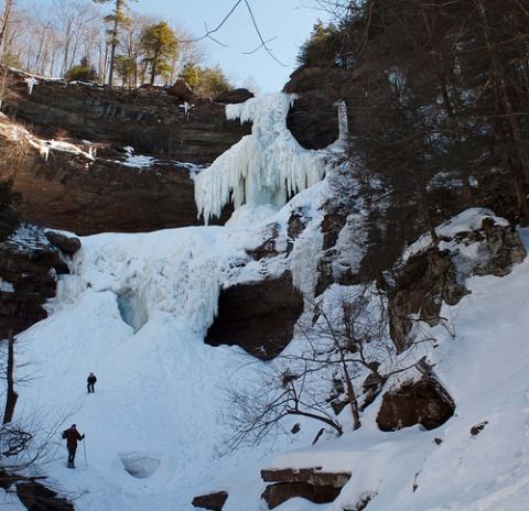
Above: Still deep winter at the icy cathedral of Kaaterskill Falls. Photo taken March 5 by Rebecca Balzac; shared in the Watershed Post's Flickr group pool.
The Northeast is bracing for yet another late-season snowstorm, due to hit the Catskills region on Wednesday and continue into Thursday.
Winter storm watches have already been issued for most of the Catskills region. A watch issued by the National Weather Service in Albany covers Greene, Schoharie and Ulster counties; the NWS's Binghamton office has issued a winter storm watch that covers Delaware County along with much of Central New York.
So far, NWS forecasters are calling for up to 7 to 9 inches of heavy, wet snow in the Catskills region, beginning on Wednesday morning and possibly changing over to sleet in some places. Temperatures will be in the 30s on Wednesday, and fall into the teens Wednesday night. The combination of snow and sleet, gusting winds and rapidly falling temperatures is likely to make road travel extremely dangerous on Wednesday night.
Hudson Valley Weather is tracking the storm's progress closely, and is predicting 6 to 12 inches of snow in the high peaks of the Catskills, with just a few inches across most of Sullivan and Ulster counties.
Update, Tuesday, March 11: A shift in the track of the storm is pushing predictions toward less snow and more rain across the Catskills and Hudson Valley. Western Ulster, Greene and Delaware counties are still under a storm watch, but the forecasted total accumulations have gone down significantly.


